Drone photography · 4 min read
Drone Photography for Real Estate NJ, What It Captures & When It's Worth It
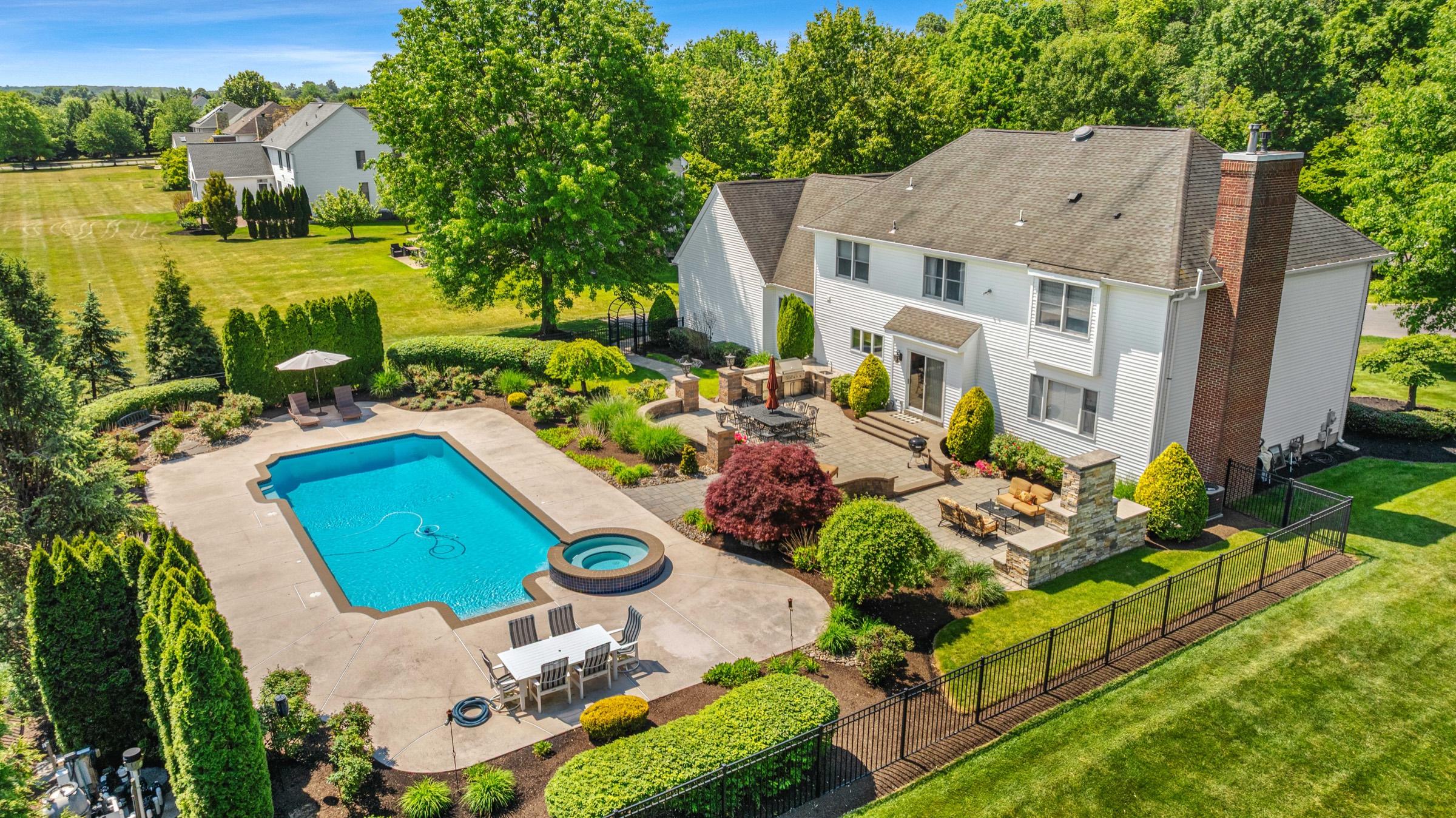
A standard photo shows what a room looks like. A drone photo shows where the home lives, its relationship to the street, the backyard, the neighborhood, the pool, the surrounding area. For the right listing, that context is what closes the deal.
What drone photography actually captures
Buyers make decisions about neighborhoods before they decide about houses. How far is the highway? Is the backyard really as big as the listing claims? What are the neighboring properties like? Is there a park nearby? None of those questions can be answered from the ground, and all of them can be answered in a single aerial frame. That's why drone is more than "a nice photo from above", it's context photography.
A skilled drone photographer captures several distinct types of shots, each doing a different job:
- The wide establishing aerial, the home within its setting, the classic hero shot that gives the listing scale and drama.
- The top-down lot view, boundaries and yard size at a glance. We can label lot lines directly on the photo so buyers instantly understand what they're getting.
- Amenity highlights, pools, patios, decks, outbuildings, and acreage that ground-level photos always undersell.
- Neighborhood context, proximity to water, parks, golf, downtowns, or major roads, the things buyers actually search for.
When drone photography is worth it, and when it isn't
Drone adds value on almost any listing, but the ROI is dramatically higher for certain property types:
- An easy yes: larger lots, acreage, waterfront, homes with pools, scenic surroundings, and new construction, anywhere the land or the location is part of the pitch.
- Essentially mandatory: estates, farms, and commercial properties, where buyers need to understand the full footprint before they'll even schedule a visit.
- Think twice: a small interior condo with no exterior story. Even then, one area shot showing proximity to the train station or downtown can add context that sells the location.
At $75 as an add-on to any package (6–10 aerial photos), drone pays for itself on most houses. Booked on its own, drone photography starts at $150 for up to 10 aerials, plus $20 per 5 additional. And if you want buyers to understand the property at a glance, our $25 Aerial Property Overview turns a drone shot into an illustrated site plan with lot dimensions, labeled features, and a property info box.
FAA licensing, why it matters and what it means for you
Commercial drone flights, including any drone photography for a real estate listing, require an FAA Part 107 Remote Pilot Certificate. This isn't optional. Flying a drone commercially without this certification is illegal, and fines can exceed $5,000 per violation.
Here's the part many agents don't know: if you publish drone footage taken illegally in your listing marketing, you and your brokerage share the liability. Plenty of unlicensed operators sell drone photos to agents who never thought to ask.
The fix is simple: ask for the FAA license number before booking. A legitimate, certified drone pilot will share it immediately. Ours is #4829484, verifiable on the FAA's public registry. Beyond legality, certification means the pilot understands airspace rules, and that matters in New Jersey, where airspace around Newark, Teterboro, and several smaller airports requires LAANC authorization that a certified pilot checks before every flight.
Ready to add aerials to your next listing? Drone is +$75 on any package, or see real aerial work in the portfolio.
Make your listings, and your brand, unforgettable.
Real estate media and professional headshots serving Middlesex, Monmouth, Somerset and communities across New Jersey. Based in Old Bridge. Next-day delivery on real estate media; business media timelines vary by scope.
Info@PickThreePhotography.com · @pickthree_photography